
Distance: Approximately 8.6 miles
Duration: Approximately 5 hours 20 minutes
This hike we did two days after the Keystone Peak Hike. As with the Keystone Peak, we left from the top of the first gondola at Keystone. Another hike that can be done if the North Peak Gondola is running is the Erickson Mine Hike.
This hike follows the Keystone Peak Hike almost to the peak of Keystone. When we were more or less at the saddle which would take us over to Independence, we left the Keystone Peak hike and crossed over.
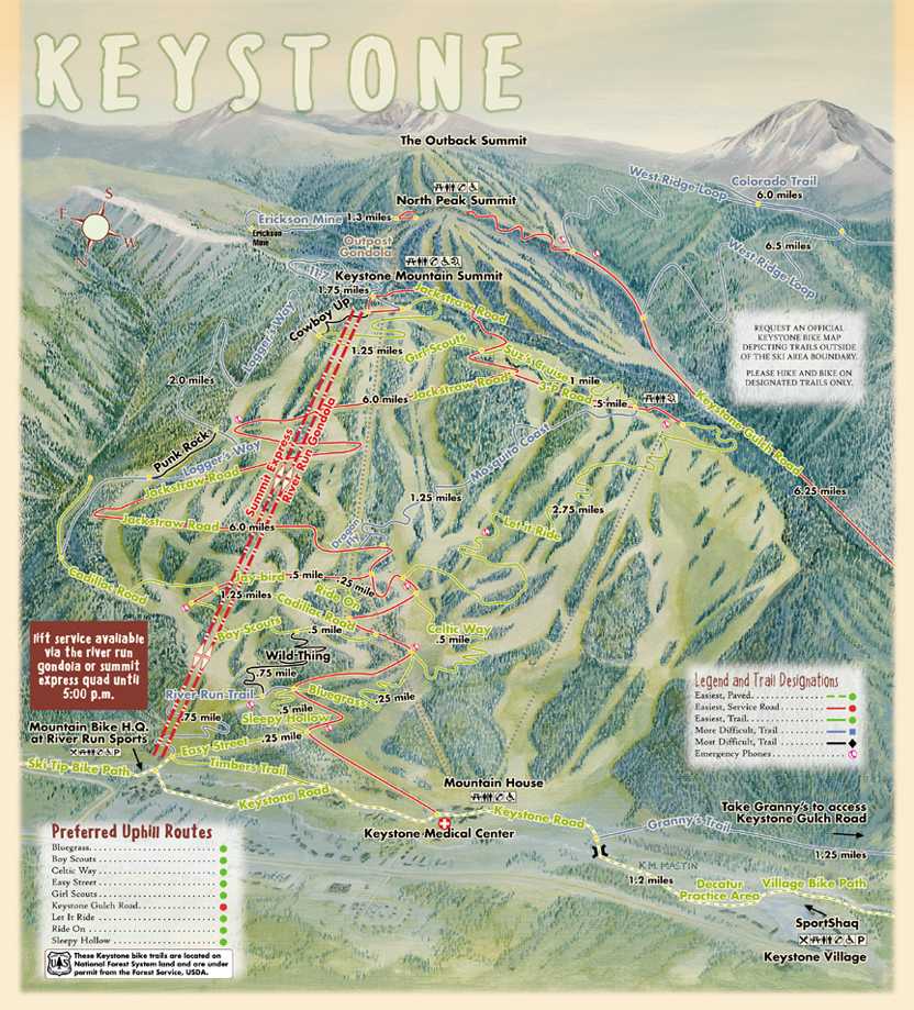
Here is a small map of the hike, and clicking on it will bring up a full page map suitable for printing if you want to take this hike:
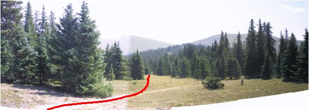
A view of Independence, Bear, and Keystone as seen from Ruby Ranch (a distance of about 11 miles):

I have copied the summer mountain bike map from Keystone and posted it on my web site here. If you look at this map, from the summit going to the left in a yeechy shade of blue is a trail marked 11:7 (I thought it was the 7:11 not 11:7 trail). We started our hike on this trail. The bike trail is in fact a loop, and you quickly come upon a junction, labeled "Junction 1" on the topo map.
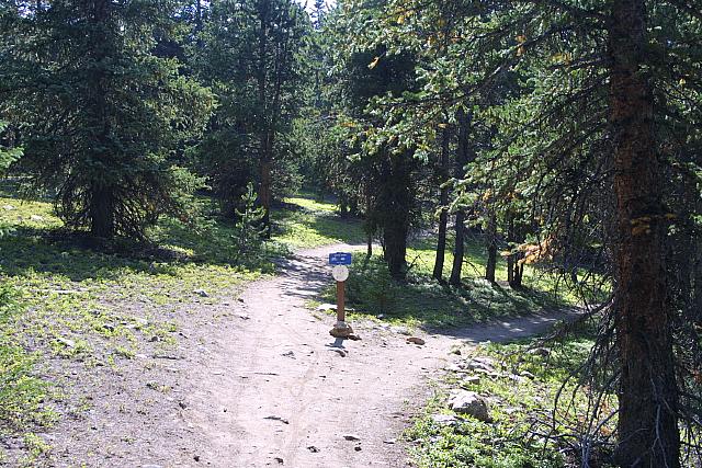
Take the upper trail (left in this picture). This junction is approximately 0.3 miles from the gondola. The trail for the most part follows the saddle that leads from the gondola to the actual Keystone peak. That is until junction 2, where upon you leave the 11:7 trail and appear to bushwhack:
We followed the trail towards Keystone Peak, until we were just above the saddle which took us over to Bear / Independence. We went above the saddle as we did not decide to actually take this hike until we left the Keystone Peak hike. However, we probably would have done it this way, as if we left earlier we would have been in some skree.
The hike to the summit was uneventful.
From the saddle between Bear and Independence, looking out towards A-Basin and Greys and Torreys:

At the summit, I could not find a USGS marker, as I believe it is buried:

We then started down towards the Ida Belle mine, continuing more or less north-northeast, following the ridge towards US 6:

As we approached the mine, we made a big mistake. Looking at the blowup of our hike:

We followed the green, and we should have hung on the ridge, following the blue trail, and we would have hit the mine road with-out a 20 minute detour through a steep skree field. Looking at it from a picture:

We should have stayed as far right as we could have, instead, we ducked under this first grouping of trees.
Looking closer at what we saw on the wrong route:

You can see the skree field between us and the cabins that we were making for, under the assumption (a correct one as it turns out) that there would be the road there.
Despite the fact that flower season is over, I did see one flower:

Continuing towards the mine:

Finally we did hit the mine cabins:

Here is a picture inside the big cabin. You can see the remains of a bed.

These are rails leading from one of the shafts. No longer in shape to
run rail cars....

This is the other cabin in this group.

Looking up at the higher part of the mine, the part we missed because of our wrong turn

Looking back up at the mine from the base of the gondola.
This page last updated August 26, 2002