Lenawee Mountain July 9, 2005
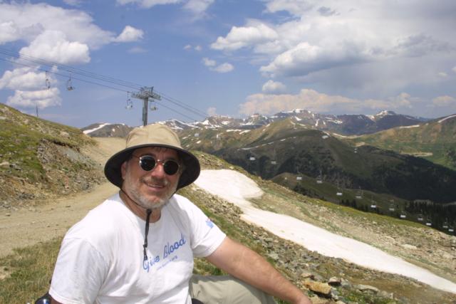
Don, Marina, and David
Distance: Approximately 6 miles
Duration: Approximately 5 hours including lunch
Elevation gain: 2162'
Elevation loss: 1605'
Total Elevation gain: 557'
This is a hike that we have been talking about doing since we moved up
here in 1997. I would have to say that once you clear tree line, it may
be the most beautiful of the hikes we have taken. This is a two car
hike, with one car parked at A-Basin and the other at Peru Creek.
Unfortunately I screwed up and somehow lost all of the pictures on the
small camera, and did not take all that many on the large camera.
Lenawee Mountain is the mountain that Arapahoe Basin Ski area is
built on (at least on the north side of the mountain). The back of the
mountain (from A-Basin's point of view) leads down into the
valley where the town of Montezuma is, and specifically for this hike,
Peru Gulch. After oversleeping by 45 minutes, we got ourselves
moving and drove up to A-Basin, where we left Marina's car. We then
drove to the trail head. I would recommend a car with good ground
clearance, or add an extra 1.6 miles on to your hike by parking in the
parking area where the dirt road to Chihuahua Gulch takes off of the
main road to Montezuma.
To get to the trail head, head out of Dillon towards Keystone on US 6.
Turn into Keystone like you were going to park at the River Run parking
lots, but keep going. The road will end in a T, with a left turn taking
you back to Dillon, and a right turn putting you on Montezuma Road.
Take the right turn. As you drive towards Montezuma, eventually the
road will take a hard left, followed by a hard right. At the beginning
of the hard left you will see a sign for a bed and breakfast. Then as
you come into the hard right turn, you will see a dirt parking area
with a dirt road leaving from it. Take this dirt road 1.6 miles. You
will pass the Maid of Orleans mine, and then a quarter mile later come
to a sign that says Lenawee trail Parking on your right, almost
immediately followed by a sign indicating the Lenawee trailhead on your
left. The parking is a bit iffy. You have to look for places on the
right where you can get your car completely off the road. There is no
parking area per se.
Here is a road map from Keystone:
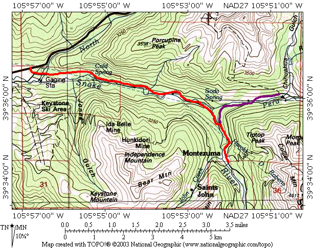
The Montezuma road is shown in red, and the Chihuahua Gulch road in
purple, to the trail head.
Here is map of the hike as plotted by the GPS. Like the Sniktau hike,
my modifications on how I use the GPS gave me essentially a noise free
plot, even in the trees.
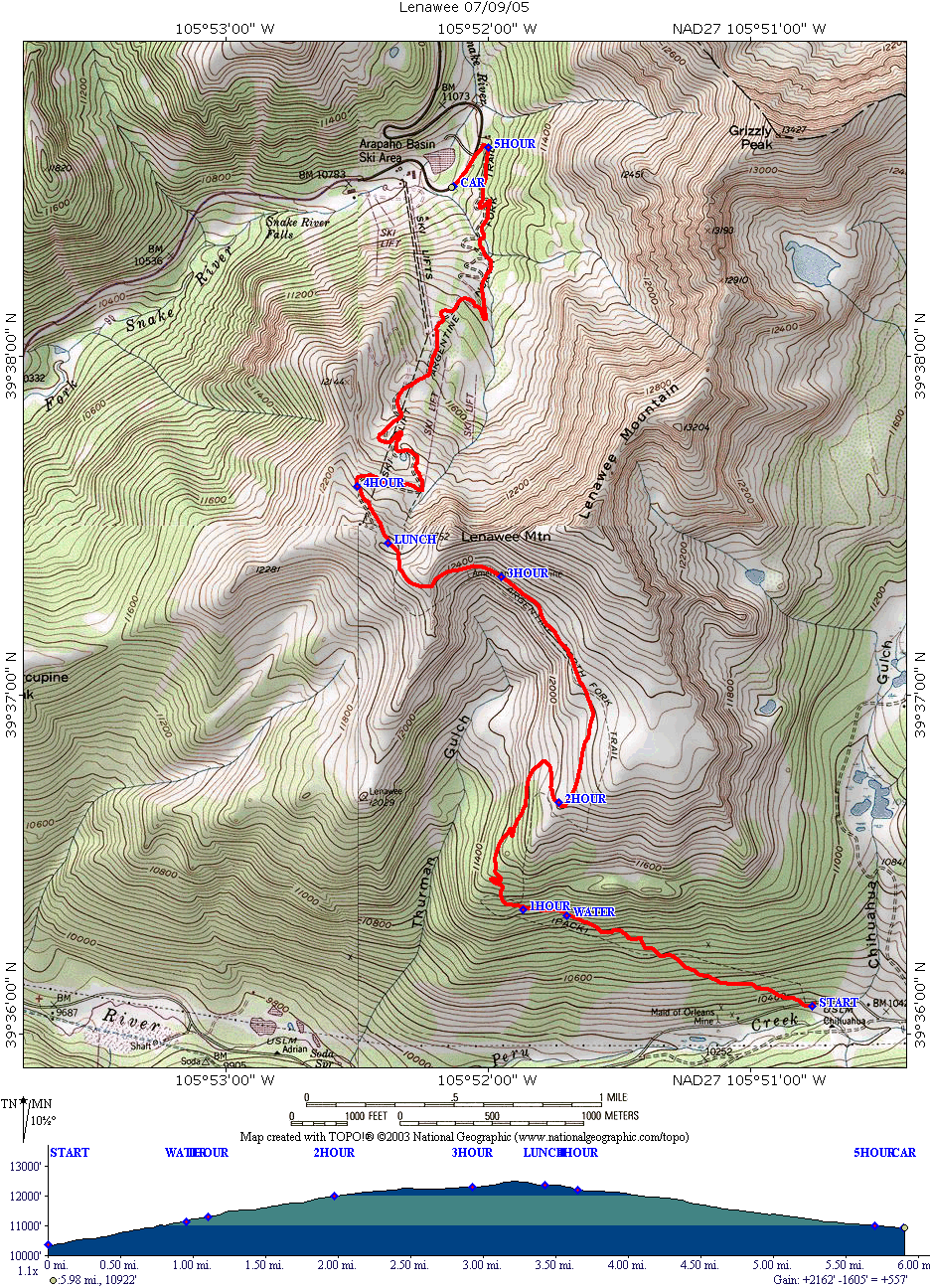
You should be able to right click on this map to view it alone and
print it.
Looking at this map and comparing my gps plot with the trail as plotted
by the USGS, you can see significant differences. The main difference
is at the 1 hour point, where the USGS has the trail going straight up
the mountain versus what we walked which took a more gradual route. I
saw no indications of trails getting re-routed, so I suspect the USGS
in this case has it wrong.
The trail itself was easy to follow, and was laid out in a manner to
minimize the "ups and downs" as well as to work around boulder fields
and scree. The steepest portion of the hike was the first hour, then
the incline became somewhat less.
The first portion of the hike, a little over an hour is in the trees
and follows a westerly coarse up the mountain. At about 45 minutes we
crossed a stream not shown on the topos. This may be an intermittent
stream, not running in a really dry year. It is also the only water we
came across on that side of the mountain. If you bring a pet, you need
water for it. If you look to the south (your left) you will
occasionally see views of Montezuma.
A little after an hour of hiking, we came to an overlook looking
westerly:
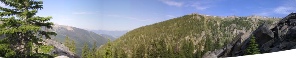
This is a merged image of 5 pictures.
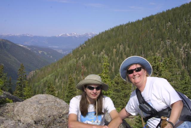
And of course a picture of David and Marina:
Continuing the hike, you turn to a northerly direction, go through a
couple of switchbacks and emerge above treeline. The meadows are
beautiful and so are the views:
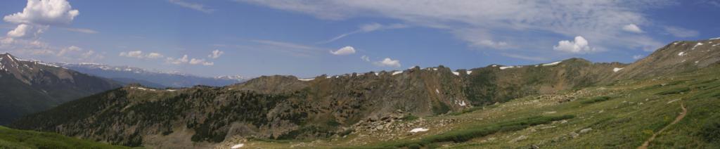
You can see the trail on the right hand side of this picture.
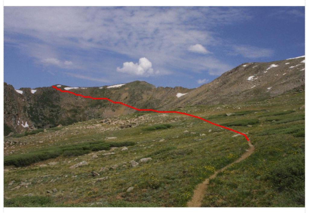
I have drawn in here the path of the trail. It basically goes through
the bowl, always gaining elevation at a moderate pace. Crossing over
the ridge brings you insight of the out of bounds markers at A-Basin.
When you look at this in person, it looks very foreboding, but in point
if fact it was no problem at all. The views to the south were
outstanding.
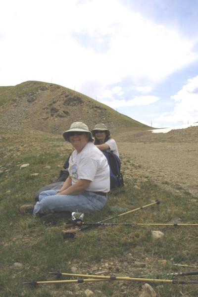
We stopped below the Lenawee lift to have a 20 minute lunch and then
continued down the road to US 6 and our car.
Lunch at the Basin:
and
Back to Hikes Page
Back to Snowedunder Home
This page last updated July 9, 2005