Duration: Approximately 6 hours 20 minutes, including lunch
This year, I have been using Ptarmigan as a training mountain to re-build stamina and leg muscles in the hope that I can get a 14er in this year. I think it is working. Sniktau, while still hiking slow, proved to be no real challenge.
As of this writing, I have "attacked" this mountain three times.
Each time, on the way up, I have choosen the old logging road rather
than what is now the main trail.
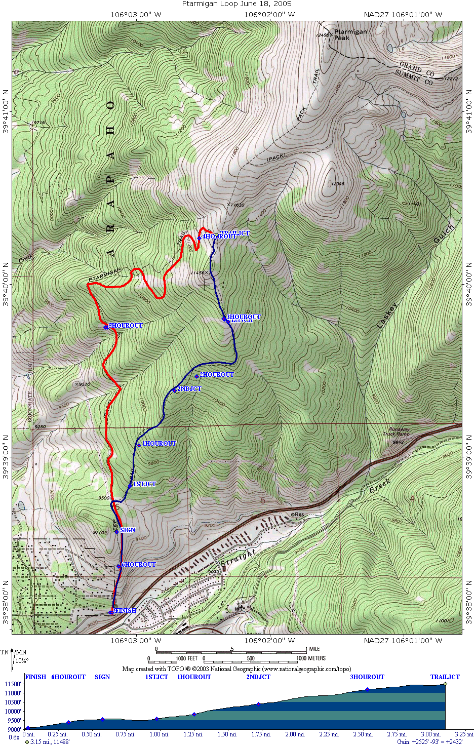
This page documents the time I made a loop of the hike, going up the
logging road and back down the main trail. As you can see at the top of
this page, using the logging road will cut off about 0.8 miles, but at
a price of an increased slope most of the hike. The logging road,
unlike the main trail has no water, so if you bring a pet, they need to
carry their water.
The map with an approximate gps plot:
The blue route is the route up, and the red route is the route down.
I have only profiled the route up. My external gps antenna was failing,
and these routes are only approximate. Perhaps I will do this again one
day with good signal to the gps the whole way.
The hike starts out at the same point as the normal Ptarmigan hike,
which we took back in 1999, and can be read about here.
The first part of the hike, which the two routes overlap, is through
easements across private property, county road, and a sagebrush meadow.
In June, this meadow is alive with many wildflowers. USFS land is
entered (presumably) at the sign.
The hike then continues with a gentle downslope through Aspens,
until the powerlines are reached.
This page last updated July 5, 2005