Acorn Creek June 17, 2007
Distance: 3 to 3.4 miles depending on the mapping tool 1 way
Times:
Up: 3 hours 45 minute (slow)
Return: 2 hours 15 minutes
Hikers: Don, Marina
Rating: Moderate
This is a wonderful hike with a trail that was very well thought out.
There are stunning views of the Gore Range to the West through most of
the trail. Low down the trail is in a valley and weaves in and out of
meadows to give you these stunning views. Higher up, but still below
the top, the trail is on a ridge which again gives stunning views. The
trail was empty as well, we only saw one other group. They were young
and much faster, both up and down :) .
Gore Range Outfitters
runs trail rides most of the way up this trail
If going all the way to the top, hiking poles are a must.
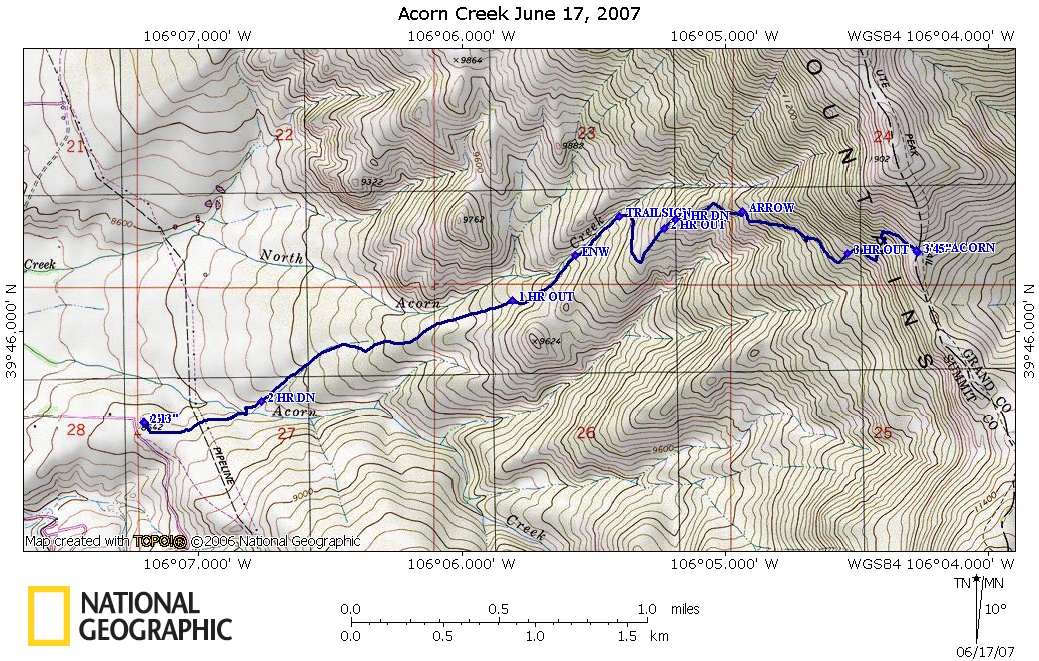
First the map, formatted to print on an 8.5 by 11 inch sheet of paper
And the profile - one way:
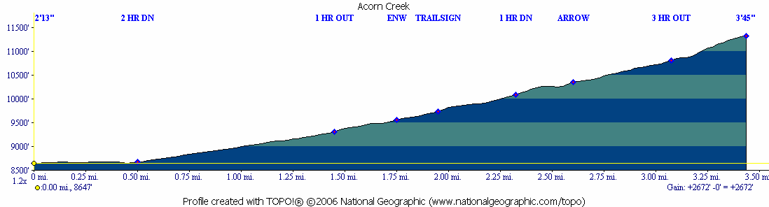
The profile above is from the National Geographic software reading the
topo maps.
Using the Garmin Software, one can get a profile based on the
Garmin unit recording the elevation. It can be seen here. This is from the gps readings
when it has enough satellites for 3D. The
gps is somewhat noisy on reading elevations and has over a 100 foot
uncertainty.
Before going on this hike, Marina found a page from the Dillon Ranger
district that also uses the National Geographic mapping software. A
link to it is here.
If you go to this page you will see that at the top my track is
much different than their track. I had two gps units on me and had them
on both up and down, essentially giving me four tracks which all
overlaid each other at this magnification. I have 100% confidence mine
is correct.
At the time of this writing, I have lost both copies of my Summit
Hiker. But what I remember from it is that Mary Ellen says the trail is
hard to follow. By the time we did this hike, the trail was not
only well "signed" but also well trodden. We had no problems finding it
and following it.
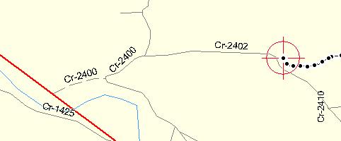
To get to the trailhead from Silverthorne, head north on Colorado 9,
the Forest Service says 10.6 miles from I-70. When the road goes over
the Blue River, leaving the Blue on your left (West), take the next
right which will be FSR2400. At this point, look for signs that
have a brown background and say "Acorn Creek". This will lead you to
the parking lot, shown here in the "cross-hairs".
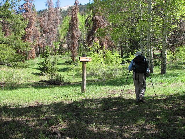
Once you have parked, walk south to the fence and sign in board. The
trail starts here. There is a cattle gate which was propped open by a
rock. The Forest Service Sheet assumed it was closed and asks
that you close it. I would say if it is open and looks like it has been
that way for some time (as it was the day we hiked) leave it open. If
it is closed then close it.
Using National Geographic elevation numbers, you are at 8647 feet.
The trail starts heading East. At about 0.25 miles you cross
under power lines. At .43 miles you cross the South Fork of Acorn
Creek. There is a bridge:
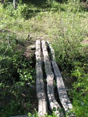
There is a slight descent to reach the creek, so you will be paying for
this real estate when you come back out with a slight climb. After
crossing the creek, the climb begins. At 1.76 miles and 9559 feet above
sea level (1 hour, 12 minutes by slow hike), you cross into the Eagles
Nest Wilderness. This happens in trees. On the way down, I noticed that
this area was rich in Columbines, which were not yet out. I may go back
and hike only to here when the flowers are out.
The meadows you hike through looks like (Marina is in the distance):
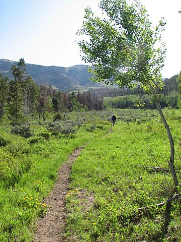
and looking back:
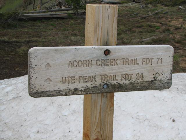
At 1.97 miles, 9741 feet above sea level (1 hour 25
minutes) you come upon a trail sign telling you to go left:
While the profiles don't really show it, I feel that the steepness of
the climb increases at this point until you reach the top. At this
point by going to the left, you climb on a compound slope out of the
valley. With the exception of one ridge, the rest of the hike is on
compound slopes.
After heading South, at about 2.2 miles / 9900 feet you do a
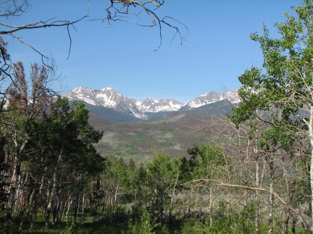
hairpin turn and head North East on a ridge that is meadow. Here
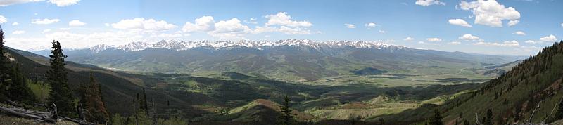
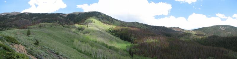
is a view of the Gore, stitched together:
If you can't make it to the top, this is a great place to get to.
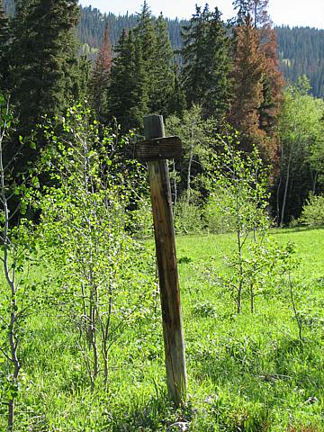
Continuing on, you go back into forest, and at 2.63 miles /
10,346 feet (2 hours 20 minutes - we slowed down), you come to a flat
spot that has an arrow:
There is a spring near by (at least there was this day) making this an
excellent campground, and a quick look shows it has been used as such.
The trail continues up mostly on a compound slope, and it starts to get
looser with footing becoming a bit more treacherous. At about 3.22
miles
(10898 feet), another hairpin turn and the trail becomes very steep and
loose, at one point having to cross over a washout. Hiking poles in
this region are a must. I made it up without them, but borrowed one of
Marina's in this area on the way down. On the way up, I had my uphill
hand on the ground the whole way.
Finally at 3.49 miles / 11,319 feet and a slow 3 hours 45minutes we
made it to the top, which of course is not a peak, but rather just a
saddle where the Acorn Creek Trail ends and joins the Ute Peak Trail.
As you can see, there were snow drifts at this time of year.
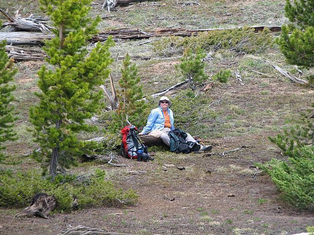
We stopped for a while up there, and had lunch.
Here is Marina relaxing:
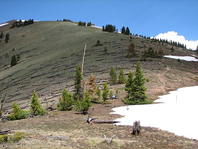
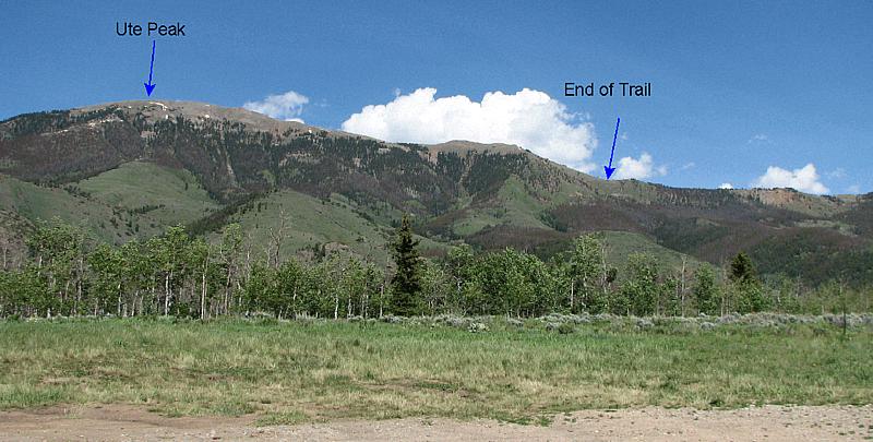
Zooming out, and looking North, the trail to a false peak on the way to
Ute Peak:
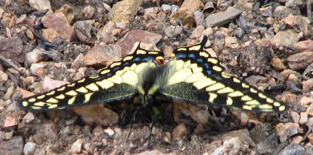
A butterfly:
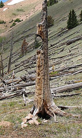
and a tree sculpture:
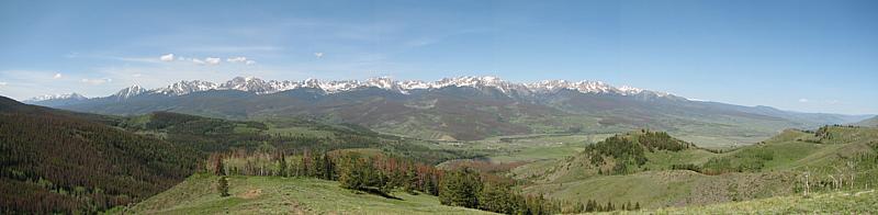
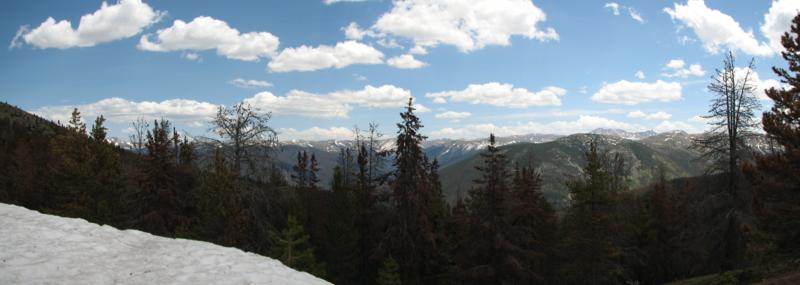
Looking at the Gore (stitched):
Looking East (stitched):
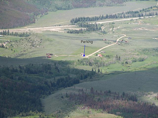
Looking down at the trail head:
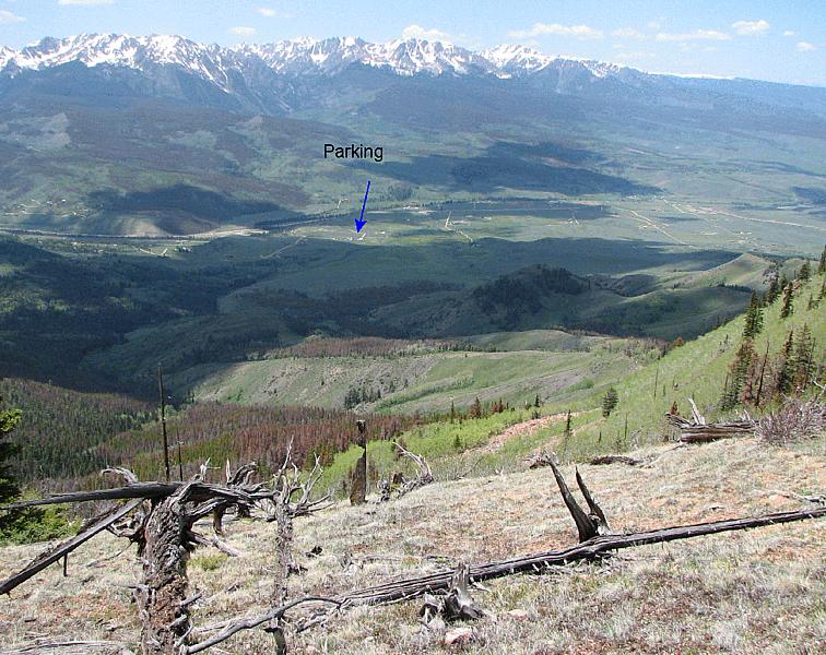
Zooming in:
We made it back down much faster than the trip up, only 2 hours 15
minutes.
Back on the ridge where the meadow is, looking up towards the top:
Looking back up from the parking lot:
Feedback to:

Back to Hikes Page
Back to Snowedunder Home
This page last updated June 23, 2007