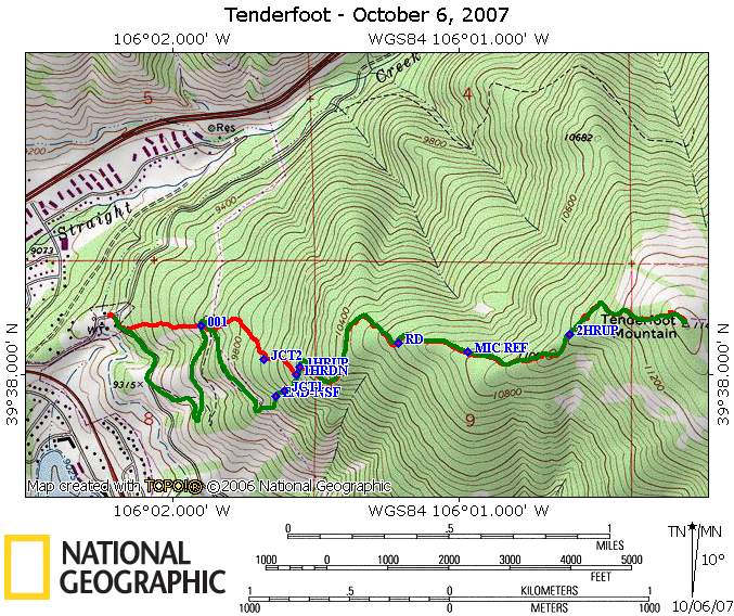
Tenderfoot October 6, 2007
Hikers: Don, Marina
Distance:
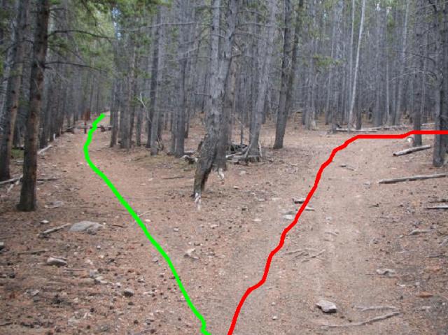
3.02 up (green on the map)
2.39 down (red on the map)
Elevation Gain 2156 feet
Time to summit: 2 hours 30 minutes
Time to descend: 1 hour 33 minutes
Rating: Moderate
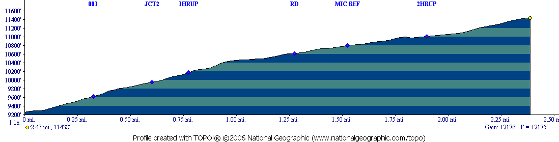
Profile going up (green on the
map)
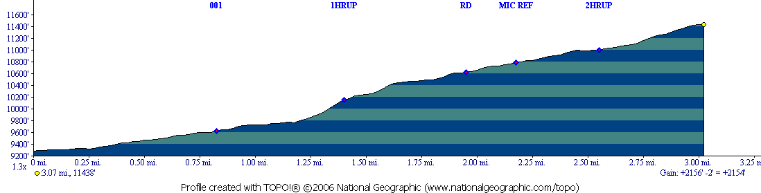
Profile going down, but reversed so if one took the red trail up, this
is what it would look like
We did this hike on the spur of the moment. The weather was
supposed to be lousy but it dawned without a cloud in the sky. Mary
Ellen's book (at least the editions that we have)
only talks about hiking to the end of the trail that is actively
maintained by the National Forest Service. This is about 1.3 miles in,
and an elevation gain of around 580 feet. This is a very easy hike to
this point, with views of Lake Dillon and the 10 mile range as a good
deal of the hike is in sage brush meadows. The trail to this point does
have blazes for winter activities.
After this point, however, the trail to the summit is not marked. We
found that the mountain was criss-crossed with trails, and while I had
my gps, we did not have any maps that showed what a trail to the summit
would be. Hiking poles are a
must, as portions of the trails that we
took are steep and loose. The route we took up, shown in green on the
map, is not the same as the route we took down (in red), which is why
the down route is shorter than the up route. From the marker "END-NSF"
to "JCT1", we followed what we thought was the trail, but was probably
made by people like us bushwhacking. If we do this again, as we close
in
on the end of the maintained trail, we will keep our eyes out on the
left for a side trail that should exist that will take us up to the
point that the green and red merge. If fact if one wanted to take a
shorter steeper route up, the red trail comes out almost at the gate
behind the service buildings
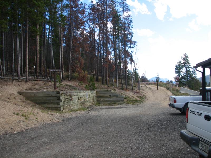
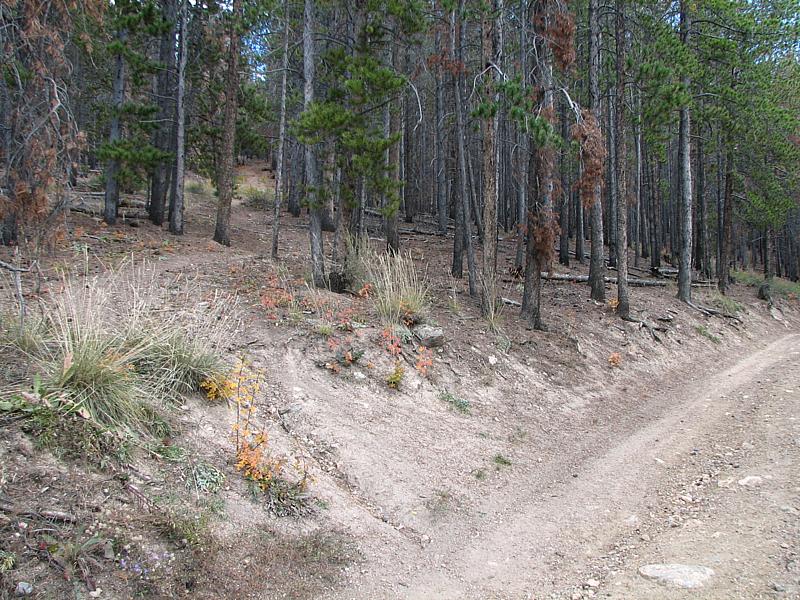
(This is the beginning of the trail, just a short bit up from the
parking lot - the sign on the middle left says "Tenderfoot Trail". You
go through the gate on the middle right).
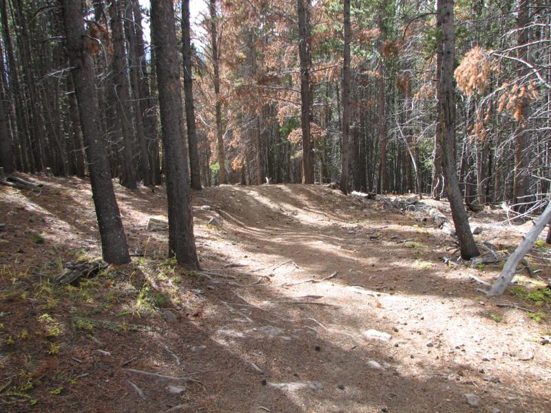
(about twenty yards beyond the gate in the previous picture is where
the "red" trail comes out).
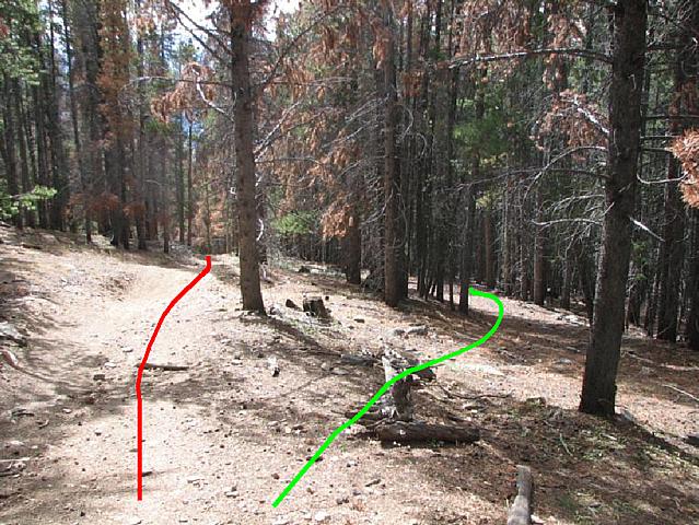
One can follow the red
trail up, sometimes with switch backs as a trail to parallel the red
trail, sometimes not. Or as you can see from the map, the green trail
(still maintained at this point) crosses the red trail twice around the
waypoint 001, at about 0.83 miles in. At that point one could head
straight up. At "JCT1", we did see a trail coming in from our left,
which we now think was headed for the red trail probably near "JCT2".
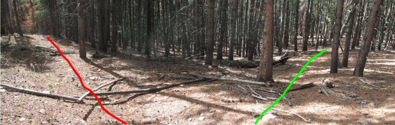
Regardless, the trail we struck at "JCT1" was the correct trail. You
can see that when it finally joined the red trail at the "1HRUP" (one
hour up) and the "1HRDN", it was doing a switch back around the
red. Continuing up the trail, when it starts to curve to the
left, it again gets very steep, and you walk along a ridge. The trail
shallows out after a couple of hundred yards and crossing the 10400
foot elevation contour. Further up, the trail then joins a road coming
in from the Dillon Cemetery area. Mark where you join the road well as
you don't want to miss this coming back down or you will be miles from
your car when you get back to the paved roads. I marked it by the fact
that in this portion, the dirt road had large pits dug into it, and had
a trail parallel to it on the Lake Dillon side. You join the road at
approximately 2 miles into the hike up.
The following pictures are looking as if you were descending.
The "pits" can be seen here:
Then the beginning of a trail parallel to the road that you only take
for at most twenty yards:
(follow the green)
and the junction itself:
The green line is the correct way to go if you don't want to end up
miles from your car.
And as you can see from this picture, the path is not very wide or well
traveled:
At 2.2 miles, a large rectangular green structure appears on your
right. Carl Oppedahl has postulated that this is a micro-wave mirror to
reflect microwave signals and change their direction. If you go to
Google Earth or Google
Maps, you can see in fact that they have cleared trees along to
paths into this mirror. The road splits at this point, and one
trail has a marker put by the NSF stating no motorized vehicles.
going up the green path on this picture you see the NSF marker:
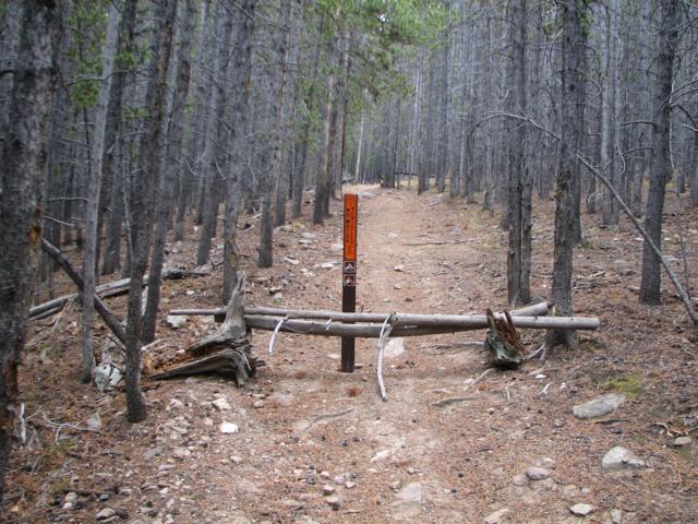
After this marker just follow the path up to the summit where it is
flat and a meadow but not really above tree-line.
Coming back down on the red trail, we basically followed what at first
just looked like a path, then slight depression of say a stream bed,
then what appeared to be a ditch. In any case as you can see from the
map, it more or less went straight down the fall line, and while over
all was steeper than the way up, was not as steep as the part from the
end of the NSF trail to where our two routes merged. Many times faint
trails left this main one to do a switchback. Here is an example,
Marina is on the switchback trail and the "direct" trail is on the left
going down:
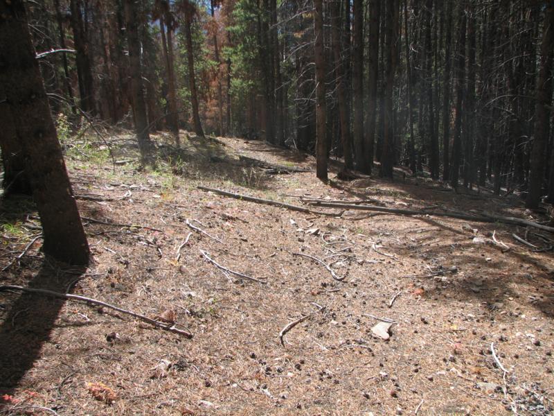
Some scenic pictures from the hike:
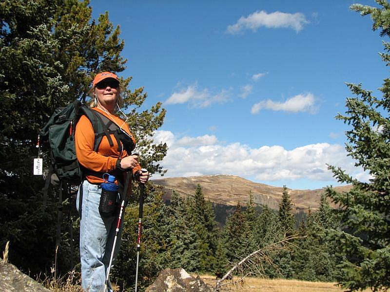
Marina on a natural cairn which we called the summit. Ptarmigan is seen
in the distance.
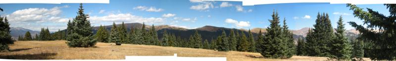
Stitched pictures going from the Gore range on the left through
Ptarmigan, over towards Lovand Pass.
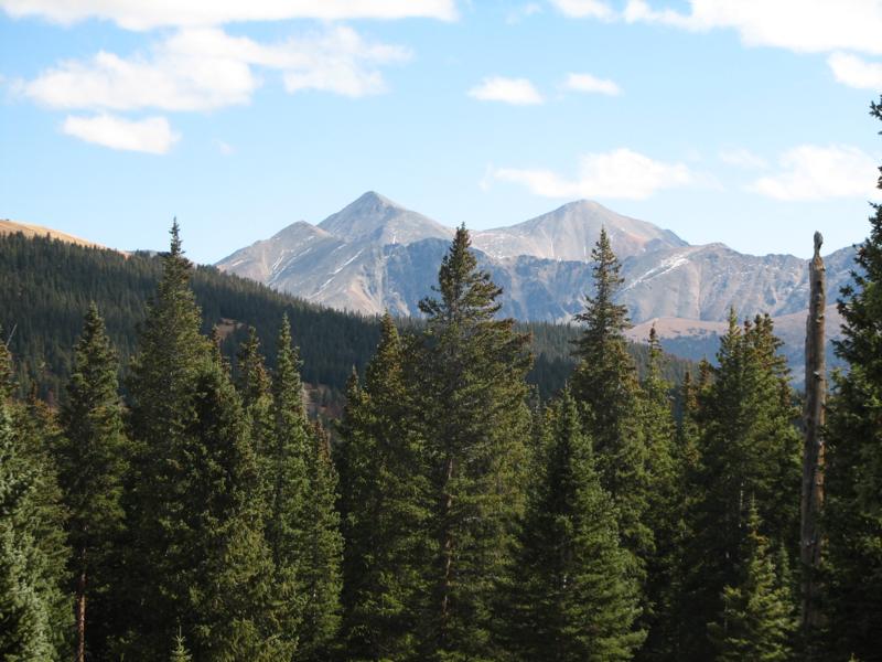
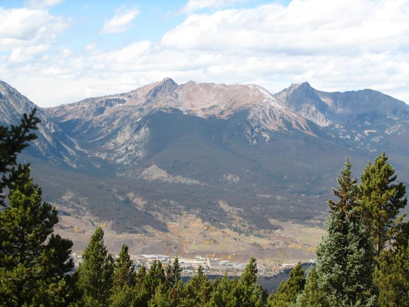
A good view of Greys (right) and Torreys (left)
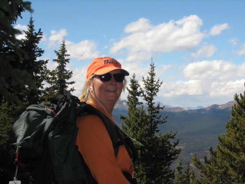
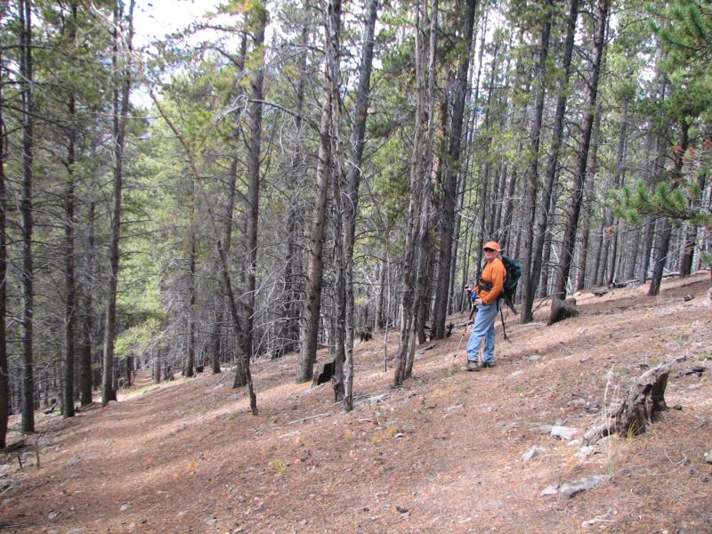
Another picture of Marina
Looking at Ruby Ranch,
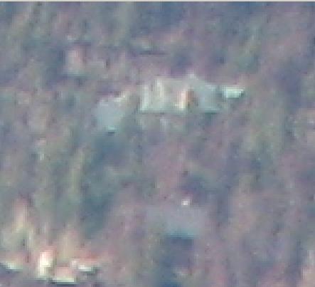
Our house. I zoomed in about where I thought the house was located,
then here the picture is blown up and pixelized. No magic CSI software
to pull out the details.
According to the Topos, this is about 5 to 5.1 miles away as the
eagle flies.
Feedback to:

Back to Hikes Page
Back to Snowedunder Home
This page last updated October 7, 2007