Ruby Ranch to Willow Lakes July 4, 2007
Distance: 7.1 to 7.25 miles, depending on the mapping tool,
one way
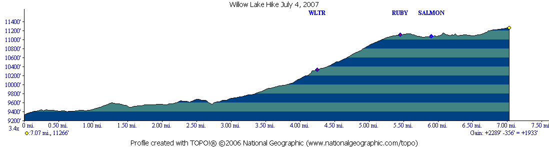
Elevation Gain: 2289' - 356' =+1933'
Times:
Up: 5 hours 6 minutes (slow)
Return: 4 hours 35 minutes (still slow, took
some breaks)
Break at top: 14 minutes.
Hikers: Don, Marina
This is a replacement for the old 1999 Hike which can be found here.
Rating: Moderate only due to its length.
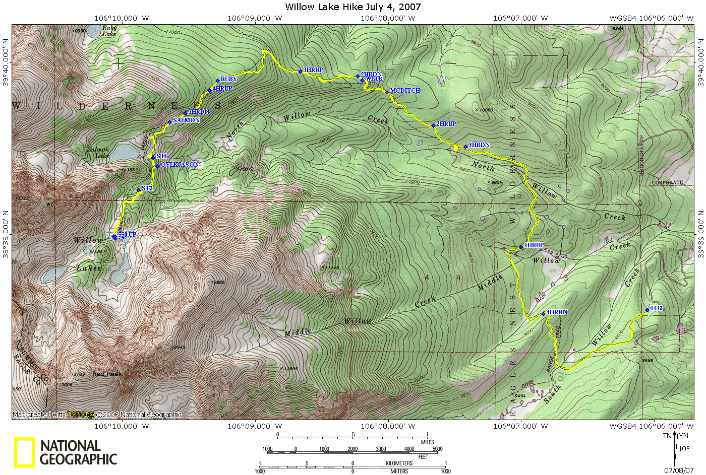
Route:
Profile:
This is a repeat of a hike we took on September 5, 1999. For all of
being 8 years later, we only took 30 minutes longer, some of which can
be attributed to the fallen trees. The hike was done after the great
Blowdown of 2007, and a map showing the downed trees as of July 4, 2007
can be seen here.
This is an all day affair. We left at 7:23am in the morning and were
back at 5:18pm in the afternoon.
Leaving our house, we hiked to the Mesa Cortina Trail, turned West
towards the South Fork of the Willowbrook, crossed it and took a right
on the Gore Range Trail, 0.93 miles out. The trail climbs over a ridge
and descends into the Middle Fork Drainage. This time of year we
crossed three streams in this drainage, and climbed back out over
another ridge. On this ridge we ran into the first significant blowdown
along this route, some of which can be seen here, documented on
a trail ride I took. We then descended down and crossed the North Fork
of the Willowbrook at 2.71 miles.
The Gore Range Trail then takes a left with a gentle climb paralleling
the North Fork. A second major area of blowdown is crossed. As of July
4, this part was cleared. At the end of the blowdown, the trail starts
a slightly steeper climb as it moves away from the North Fork towards
the North. At 4 miles you cross an irrigation ditch that I think goes
to Maryland Creek. This does not look like a ditch, but back on one of
the 1999 hikes, when we went up it was running and when we came back it
was dry. This is on the map as "MCDITCH"
At 4.27 miles the Willow Lake Trail leaves the Gore Range Trail. This
trail junction is at a completely different point than the map shows.
If one wanted to continue on the Gore Range Trail, one would
immediately run into another large blowdown, rendering the trail
impassible. We are not sure when this portion will be re-opened. It can
be seen here:

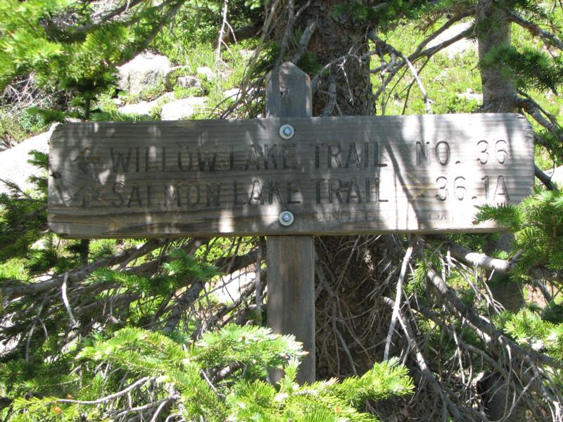
The trail sign (seen in the shadows above) looks like:
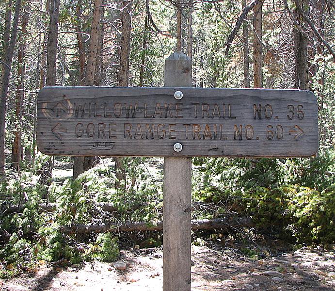
This is on the map as "WLTR" but is partially obscured by the 2 Hour
down marker "2HRDN"
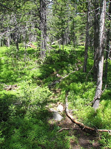
And as you can see, trees are across this trail as well. Assuming that
the trees are not there, the trail continues westward. At about 4.8
miles the trail turns to the Northwest, and climbs on the side of a
hill on a compound slope. At 5 miles you hit a switch back and
continue on the compound slope climb. Eventually the trail turns
towards the right and levels out. Both sides of the trail are now
relatively flat with the trail being the high point.
At 5.5 miles a very small trail appears on your right. We think this is
the trail to Ruby Lake which is not marked. A close look a the topo
would indicate that if you took a constant contour, this would take you
to just above the lake. Here is a picture of the trail( "RUBY" on the
map):
It is easier to see in person than in the picture. If you are looking
for this trail, by paying attention to the trail you are on, you can
know if you have gone past, because just after this point on the trail,
you loose walking on the flat, the trail starts a slight descent, and
you are on a compound slope again with the hill falling away on your
left.
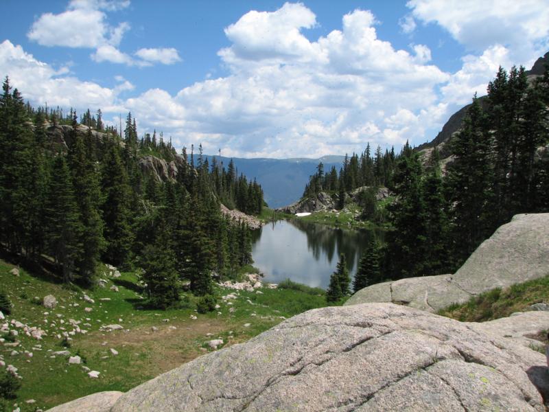
At 5.93 miles you come to the cut-off for Salmon Lake. This is well
marked (and is on the map as "SALMON"):
At 6.3 miles you cross the outflow from Salmon Lake. In hindsight we
should have brought our water shoes along at this time of the year and
changed into them for this crossing as we both took a bit of water in
our boots. This is indicated on the map by "ST1". Slightly past this
creek you will see a side trail going off to your left. On the way back
down, I went to see where this leads. There is a nice flat spot with a
fire ring, and you can see the following overlook, indicated on the map
by "OVLKJASON":
There is also a sign on a tree saying "In memory of Jason Richmond who
passed this way". Not sure who he was or how long the sign has been up.
At 6.56 miles, a second creek is crossed, this one being part of the
Willow Lake drainage system("ST2" on the map).Water shoes also would be
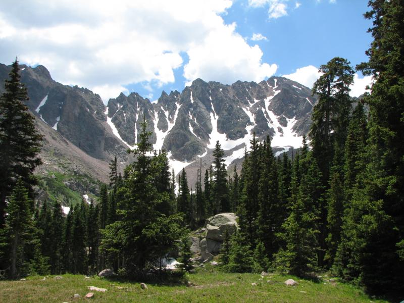
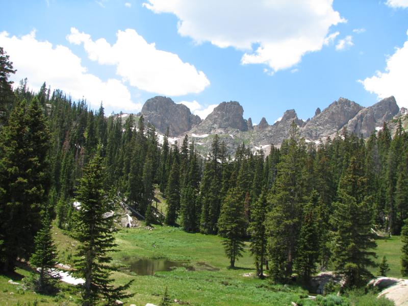
good here. At 7.1 miles we climbed a bit off the trail and stopped for
lunch. We were just in the Willow Lake area, not near the end which
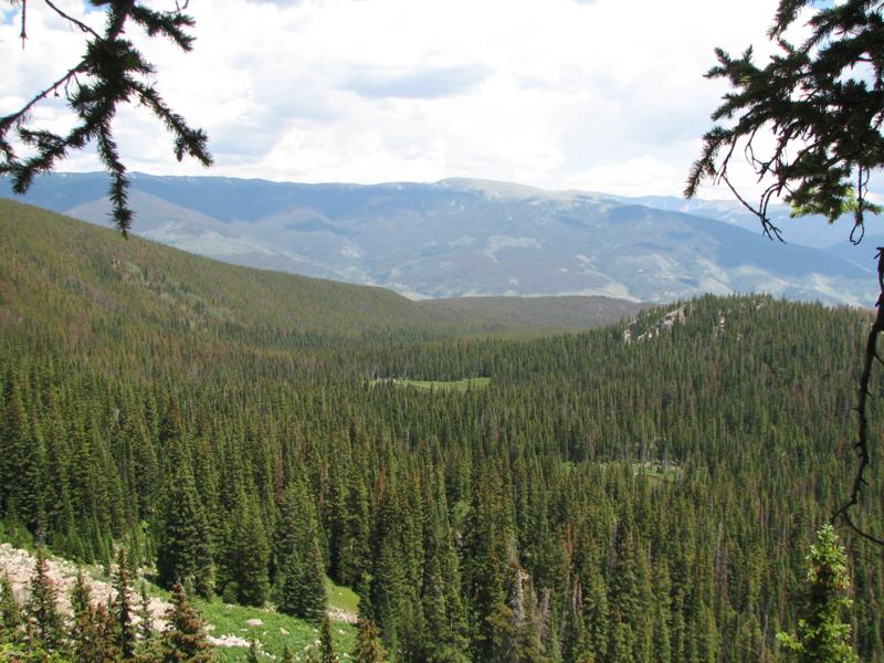
would be another half mile further. The views were awesome here:
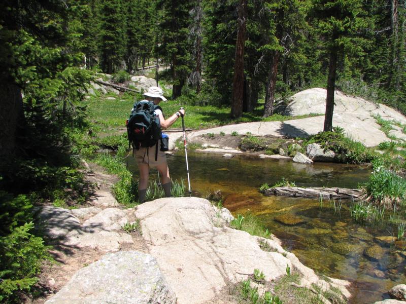
Here is the crossing of the
stream that is part of the Willow Lake drainage. It is in fact a small
pond.
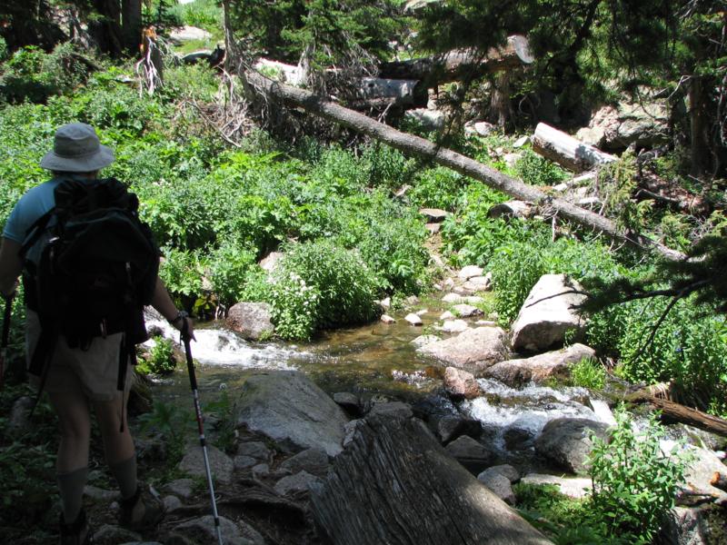
Here is the crossing of the outflow from Salmon Lake.
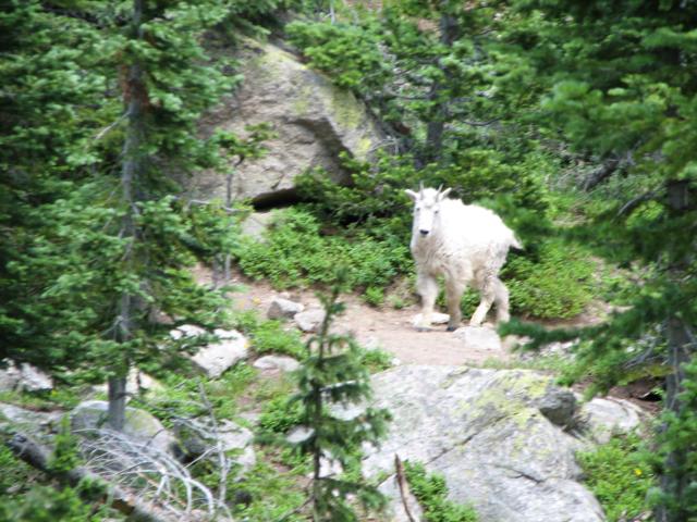
When we got back to the Salmon Lake cut-off we saw this:
Feedback to:

Back to Hikes Page
Back to Snowedunder Home
This page last updated July 8, 2007